How to use clouds to predict the weather while hiking
This post may contain affiliate links. This means that we may receive a small commission from purchases through those links. Read more in our affiliate disclosure.
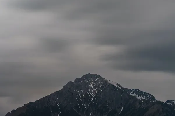
As we venture into the wilds, an awareness of the weather becomes paramount. Weather dictates our choice of gear, the trail’s difficulty, and even our safety. Despite our technological advancements, we often overlook a powerful, old-school tool in forecasting what Mother Nature has in store for us – clouds. By understanding their different types, formations, and behaviors, we can decipher the clues they provide about upcoming weather.
Clouds serve as a natural tool for predicting upcoming weather, crucial for hikers. Different types such as cumulus, stratus, and cirrus can indicate fair weather or upcoming storms. Cloud colors, specifically darkening clouds, often signal imminent rain, while red or pink clouds can indicate weather trends based on the time of day. The altitude, speed, and direction of clouds also play a part in weather prediction, with low clouds often indicating rain, fast-moving and high clouds signaling potential changes, and the general movement from west to east being the norm in mid-latitudes. However, cloud-based weather prediction has its limitations, given the complex atmospheric processes.
- Introduction
- How are Clouds Named?
- Why Are Cloud Types Important for Weather Prediction?
- What Can Cumulus Clouds Tell Us?
- What can you learn from Stratus Clouds?
- What Do Cirrus Clouds Indicate?
- What Do Altocumulus Clouds Signal?
- What do Lenticular Clouds tell us?
- What do Mammatus Clouds indicate?
- How Do You Tell If It Will Rain With Clouds?
- Do Nimbostratus Clouds Mean Rain?
- Are Cumulonimbus Clouds a Bad Sign?
- Are Altostratus Clouds a Precursor to Rain?
- Can Low Clouds Indicate Rain?
- What Can High Clouds Tell Us About Upcoming Weather?
- How Can Cloud Colors Help Predict the Weather?
- Can Cloud Speed and Direction Predict Weather Changes?
- What Does Fast-Moving Clouds Indicate?
- How to read the Direction of Cloud Movement?
- What does it mean when clouds seem to form waves?
- How Reliable Is Cloud-Based Weather Prediction?
- Conclusion
How are Clouds Named?
Cloud names may sound like a strange language, but they follow a systematic approach. The language of clouds is a mix of Latin words and prefixes that describe their appearance and altitude.
How Cloud Forms are named
There are four primary cloud “forms” or shapes:
- Cirrus: These are wispy and thin clouds that usually appear high in the sky. “Cirrus” translates to “curl of hair” in Latin, reflecting their delicate appearance.
- Cumulus: The term “cumulus” comes from the Latin word for “heap” or “pile,” aptly describing these fluffy, heap-like clouds that often resemble cotton balls in the sky.
- Stratus: Stratus clouds form layers or wide sheets in the sky, often covering it entirely. “Stratus” comes from the Latin word for “layer.”
- Nimbus: Nimbus clouds are the bearers of precipitation. The term “nimbus” is derived from the Latin word for “rain.”
How Altitude Prefixes Work
To indicate the altitude at which the clouds typically occur, prefixes are used.
- Cirro-: This prefix is used for high-level clouds that usually occur above 20,000 feet. Cirrus, cirrostratus, and cirrocumulus clouds fall into this category.
- Alto-: Mid-level clouds that typically form between 6,000 and 20,000 feet use the prefix “alto-.” Examples include altocumulus and altostratus.
- No Prefix: Low-level clouds that are generally found below 6,000 feet don’t have a specific prefix. These include stratus, cumulus, and stratocumulus clouds.
Compounds and Special Cloud Types
When you start to combine these terms, you get specific names for different cloud types, and you can understand a lot about a cloud just from its name.
For example, a cumulonimbus cloud is a towering, heap-like cloud (cumulus) that brings precipitation (nimbus). Hence, you know just from the name that a cumulonimbus cloud is a thunderstorm cloud!
There are also special cloud types like “mammatus” from the Latin mamma (meaning “udder” or “breast”), which describes the unique, pouch-like formations often found hanging beneath the base of cumulonimbus clouds.
In essence, the cloud names work like a brief description, giving us valuable insights into the cloud’s shape, altitude, and whether or not they might bring rain or snow.
Why Are Cloud Types Important for Weather Prediction?
Clouds are visual representations of the processes taking place in the atmosphere, each with its distinct characteristics and implications for weather conditions. An excellent resource for identifying these and other cloud types is provided by the National Weather Service.
What Can Cumulus Clouds Tell Us?
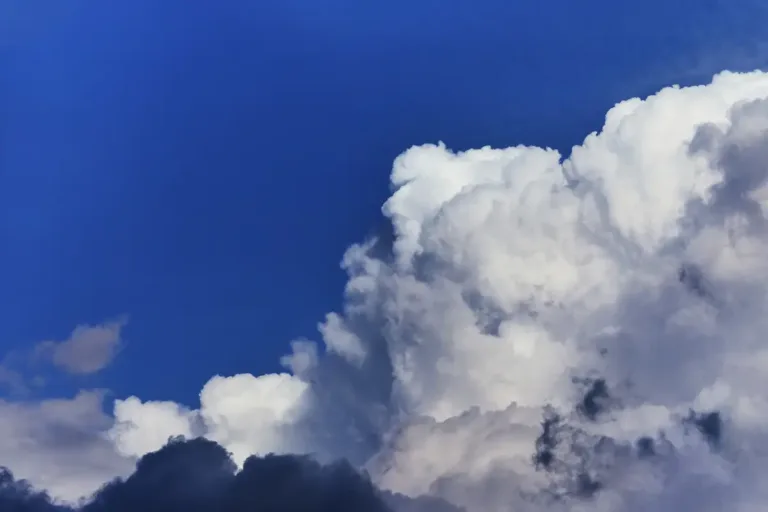
Cumulus clouds are those puffy, cotton-like clouds that you often see on clear, sunny days. They’re typically associated with fair weather when they’re small and isolated. However, if you notice them growing taller through the day, they could evolve into cumulonimbus clouds, signaling a possible thunderstorm in the afternoon.

What can you learn from Stratus Clouds?
Stratus clouds are flat, gray clouds that often cover the entire sky in a blanket-like layer. They’re typically associated with overcast days and can bring light drizzle or flurries in colder temperatures. If they start to thicken and lower, be prepared for persistent rain or snow.

What Do Cirrus Clouds Indicate?
Cirrus clouds are thin, wispy, and located high in the sky. They are often the first sign of an incoming warm front, which could mean prolonged precipitation in the next 12 to 24 hours if they thicken and lower into cirrostratus clouds.

What Do Altocumulus Clouds Signal?
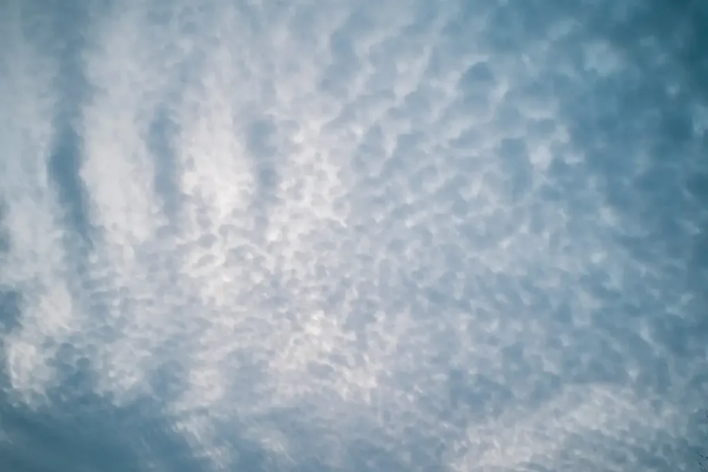
Altocumulus clouds are mid-level clouds, appearing as gray or white patches. They often form a “mackerel sky,” looking like the scales of a fish. When you see these in the morning, especially on a warm and humid day, it often means that thunderstorms may occur in the afternoon.
What do Lenticular Clouds tell us?
Lenticular clouds, or Altocumulus lenticularis, have a distinctive lens or almond shape. They usually form over mountain ranges when moist air is forced upwards. These clouds do not move with the wind, giving the impression of being stationary. Lenticular clouds don’t usually bring bad weather, but they can signify strong winds at higher altitudes, which is critical information for mountaineers. Check out the this article for more on these fascinating formations.

What do Mammatus Clouds indicate?
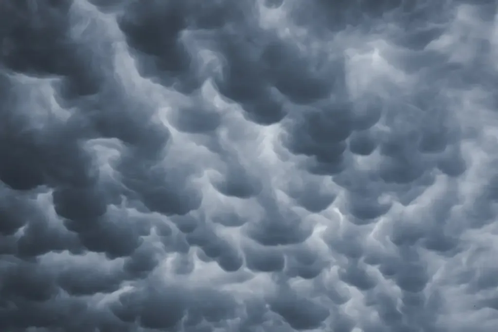
Mammatus clouds are pouch-like cloud structures, often seen hanging from the base of cumulonimbus clouds. While they look ominous, mammatus clouds don’t bring severe weather but often occur after a thunderstorm has passed. You can read more about them in this scientific article on their formation and characteristics.
How Do You Tell If It Will Rain With Clouds?
If we look closely, the sky can give us ample warning before it decides to soak our gear. The thickening and lowering of clouds, especially into a layered, gray stratus formation, often precedes rainfall.
Do Nimbostratus Clouds Mean Rain?
Yes, they do. If you spot thick, dark, low clouds that cover the sky and block out the sun, they’re likely nimbostratus clouds. This type of cloud often brings persistent, widespread, and steady precipitation. You might want to pitch that tarp and get ready for a damp day.

Are Cumulonimbus Clouds a Bad Sign?
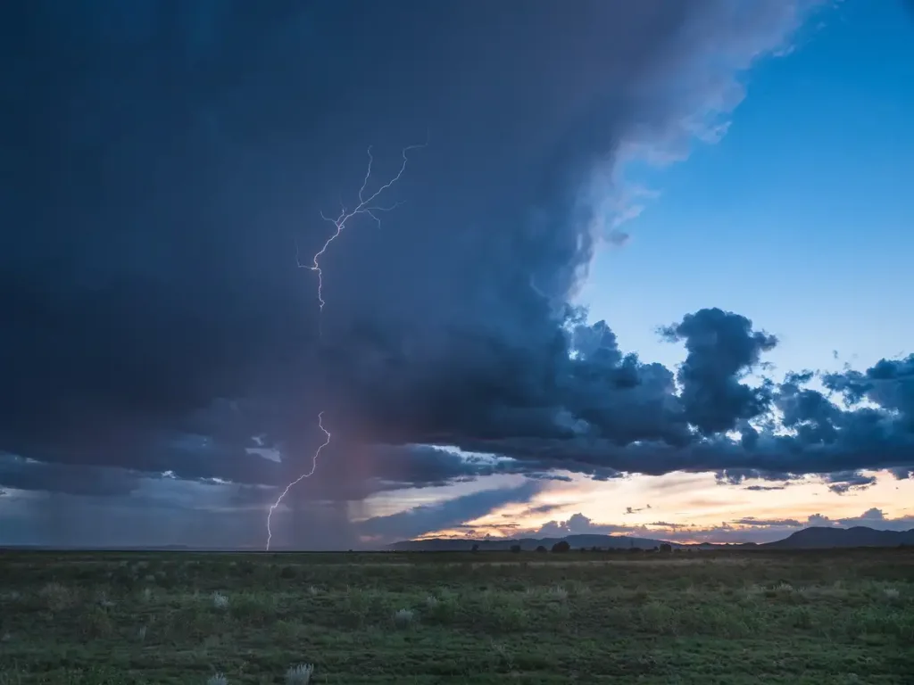
Cumulonimbus clouds, the ‘thunderheads’ you see towering high into the sky, are a definite sign of an approaching storm. Their anvil-like tops signal powerful updrafts and instability in the atmosphere. Expect heavy rainfall, thunder, lightning, and even hail when you spot these ominous giants.
Are Altostratus Clouds a Precursor to Rain?
Yes, indeed. Altostratus clouds often appear as a gray or blue-gray blanket covering the sky, barely letting the sun through. These clouds usually form ahead of storms with continuous rain or snow.
Can Low Clouds Indicate Rain?
Indeed, the altitude of clouds is another crucial aspect to consider when trying to read the sky. Low clouds like stratus or nimbostratus often indicate colder weather and rain. They form closer to the ground due to cooler temperatures and higher humidity. If you observe these clouds lowering and thickening, you might want to waterproof your pack and brace for potential rainfall.

What Can High Clouds Tell Us About Upcoming Weather?
High altitude clouds, such as cirrus or cirrostratus, can be a bit more complex in their messaging. They are made of ice crystals due to the freezing temperatures at their altitude and often indicate fair but changing weather. However, if they start to cover the entire sky and lower into altostratus, expect a warm front to arrive with potential precipitation within the next 12 to 24 hours.
How Can Cloud Colors Help Predict the Weather?
Colors of clouds can be an essential clue to determining weather changes. But how exactly?
Why Do Clouds Sometimes Turn Dark?
When clouds pile up, they can prevent the sunlight from penetrating through. This shadowing effect makes the cloud appear darker. So, if you see a cloud darkening, it might be growing denser, indicating an increased likelihood of rain or even a thunderstorm.
What Does a Red or Pink Cloud Mean?
A red or pink cloud often appears at sunrise or sunset, and it generally doesn’t indicate a change in the weather. However, the old saying “Red sky at night, sailor’s delight; red sky at morning, sailors take warning” has a basis in truth. A red sky at night can mean that the setting sun is sending its light through a high concentration of dust particles, indicating high pressure and stable air coming in from the west. Therefore, good weather will follow. A red sunrise can indicate that good weather has passed and a low-pressure system (storm system) may be moving from the west.

Can Cloud Speed and Direction Predict Weather Changes?
Indeed, they can. The direction and speed of cloud movement can tell you a lot about wind patterns, which are closely tied to weather changes.
What Does Fast-Moving Clouds Indicate?
Fast-moving clouds suggest strong high-altitude winds and possibly a coming change in weather. It’s especially true if these clouds are high cirrus clouds moving in from the west, indicating a warm front and potentially a storm within a couple of days.
How to read the Direction of Cloud Movement?
In the mid-latitudes, including North America, weather systems generally move from west to east. If you notice clouds moving from the east, a weather system might be backing up, possibly indicating unsettled weather. However, cloud movements can be affected by local wind patterns, so it’s not a foolproof indicator.
What does it mean when clouds seem to form waves?
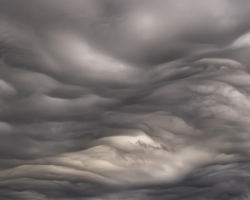
If you’re seeing a distinct pattern of waves in the underside of a cloud layer, you’re likely observing a phenomenon known as “Kelvin-Helmholtz waves” or “Kelvin-Helmholtz instability.” This pattern often looks like rolling ocean waves and forms when there’s a velocity difference across the interface between two fluids, such as wind blowing over water.
In the case of clouds, this happens when two layers of air are moving at different speeds or directions. The upper layer of air is usually moving faster than the lower layer. This causes the cloud at the top of the lower layer to scoop up and form the wave pattern. While the sight of these wave clouds can be awe-inspiring, they are often indicative of atmospheric turbulence. In some cases, they may warn of potential instability for aircraft.
Kelvin-Helmholtz waves themselves are not usually direct indicators of specific upcoming weather events like rain or storms. Their presence primarily signifies that there is instability and turbulence in the atmosphere, as they occur when two air layers have significant velocity differences.
That said, this kind of atmospheric instability is more often observed when weather is changing. If you’re seeing Kelvin-Helmholtz waves, it might be an indication of wind shear and turbulent conditions at higher altitudes, which can sometimes precede storm formation.
How Reliable Is Cloud-Based Weather Prediction?
While clouds can provide valuable clues, their interpretation isn’t always straightforward. Cloud reading is an imperfect science due to the immense complexity of atmospheric processes. However, it can certainly enhance your understanding and anticipation of the weather, particularly when combined with other information like weather forecasts and barometric pressure changes.
For more nuanced and location-specific cloud interpretation, tools such as the CloudSpotter app and guides like the Field Guide to the Atmosphere can be invaluable resources.
Conclusion
Observing and understanding clouds can be an intriguing, practical part of your hiking experience. It helps you connect more deeply with the environment while giving you an edge in anticipating weather changes. So next time you’re on the trail, remember to glance up at the sky. Those clouds are more than just beautiful; they’re your weather guide in the great outdoors. Be safe, be prepared, and happy hiking!